From the first time we visited the Western MacDonnell Ranges just outside of Alice Springs in the Northern Territory we knew we would we return to take advantage of the 223 km long well marked Larapinta hiking trail. Our goal is to eventually hike it in its entirety, but up to this point we have been happy exploring sections of the legendary trail.
Our most recent visit was just over a year ago. We had scheduled a few days in Alice Springs as we traveled from Darwin to Adelaide. It was the beginning of winter. The frosty winds had arrived to the sunburned country, and with most nights dropping to below freezing we didn't expect too much competition for camping spots. Of course we had once again underestimated the hearty Australians and some of the larger campgrounds, especially those with amenities, were busy. Fortunately, there are some smaller sites, only reachable by 4wd, so we were able to find the solitude we were looking for.

With the short days of winter, we had planned to hit the trail early. As we approached the trail head at dawn, the gentle light turned the rolling hills of the surrounding area a mystical blue and purple, colors that can only be found in the outback.

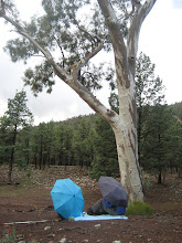
The track to the trail head took us past the ridge top campground. Even though there was only one campsite set up, we decided that to be on the safe side it would be best to set up our tent and claim one of the perfect camping spots.
By the time we hit the trail head, the landscape was no longer swathed in the soft pale pastels, but was now a pallet of vibrant reds, oranges, greens and whites.
Under the brilliant blue sky, we walked along a dry sandy creek bed that was lined by giant red river gums. As we followed the white sandy track, it wasn't long before we arrived at the base of the towering red rocky cliffs, and we began our ascent. The trail zigzagged it's way up the hill, and within half an hour we had arrived at a saddle on the mountain's spine. For the next hour and a half we walked eastward along a rocky, gentle sloping ridge. We arrived at our final destination that was marked by a cairn, and were rewarded with sweeping views in all directions. As we sat down to eat our lunch and enjoy the view, we had no idea that we had not really conquered Mt. Sonders. Even though a plaque pronounced the area we sat on as Mt. Sonders, the real peak stood a mere 750 meters away. We didn't learn this until after the fact. But even though we only sat at 1360 meters, the views were still spectacular.


No comments:
Post a Comment