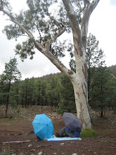
Now that we had found the perfect campsite it was time to hit the trails. We pulled out our much used Northern Grampians Outdoor Recreation Guide to see if there were any bushwalks nearby. We discovered that not far away was an area with a couple of short hiking trails to Aboriginal Art Sites. Unfortunately, we knew that these trails would be packed with people. However, it was also possible to combine three local dirt tracks to create a 16km loop hike. We decided to go for it and headed over to the Buandik Picnic Area.
Our hike consisted of two tracks, Goat Track and Victoria Track, which were open to 4wd vehicles. We knew that the dirt roads would be fairly easy terrain to hike. The third track, Hut Creek, was a maintenance track that was closed to 4wd use. We could only hope that this track would be maintained or at least passable.
Since it was well past noon, we ate a quick lunch in the picnic ground and hit the road. We followed the route clockwise, which meant the closed road would be last. This was a bit of a risk because we had no idea what condition it would be in, but we figured if worse came to worse we could always turn back.
The Goat Track lead us quickly away from the canyon bottom. About 20 minutes into the hike there is a wonderful lookout over the plains that surround the Grampians--it would have been the perfect lunch spot if we hadn't already eaten our lunch.
As the trail continues to gradual climb it passes through forests of woodland banksias, eucalyptus, and native pines. As we gained altitude the pine forests became thicker. Their sap dripping trunks and branches filled the air with their rich aroma, a smell that momentarily transported me to the southern mountains of New Mexico. However, I was quickly brought back to the present when I spied a wallaby enjoying an afternoon nibbly of some of the fragrant resin.

About 45 minutes into our hike we merged with the Victoria Track. Here we began to follow a ridge that passes through some of the magnificent rock formations for which the Grampians are famous. The carved boulders and sheer cliffs of the area are perfect examples of the relentless impact of erosion on the soft sandstone rock. The red tors and scraggly peaks that stood in the distance beckoned us, but unfortunately we would not be visiting them on this trip.
The second track was a bit longer than we thought and we began to worry about the condition of the next track. It was getting late enough that if we had to turn around we would be hiking in the dark. At about 2 1/2 hours in we finally hit the junction. To our relief there was a couple who had just come up the route, so we knew that it was passable.


It sounds like a great hike. It would be very cool to see the banksias and smell the forest.
ReplyDeleteHi Maya, wonderful post and I really enjoy reading how you describe what you are seeing, the aromas and your thoughts during your hike. Great photos. It is so cool to come across a wallaby enjoying his afternoon snack. Thank you so much for sharing.
ReplyDeleteMarta, the smell of this forest reminds me a lot of the forests back in New Mexico--it was very soothing for the soul.
ReplyDeleteKathy, wallabies are probably my favorite animals and I love when we stumble across one.