Wednesday, March 31, 2010

A Stack Of Rocks

Our arrival at pancake rocks was announced not by the iconic land formation, but instead by the numerous cars that filled the parking lots and lined the sides of the highway.  If it hadn't been for all the different rental stickers on the vehicles I could have sworn that we had just pulled into a Camper Van Rental lot.  
To be truthful my heart sunk a bit.  I knew that with so many other visitors I would never be able to fully appreciate the "sight" we were about to visit--I much prefer those private, silent moments with mother nature.
We made a quick call into to the tourist office and then headed over to the Pancake Rocks walkway.  A sealed track leads visitors through a brief section of rainforest and a forest of flax before reaching Dolomite point.  

Here visitors can observe--if they take time to slow down--limestone rocks that have been carved by the sea. The formations resemble stacks of pancakes--hence the name Pancake Rocks. 

In addition to sculpting the rocks, erosion has also left holes in the limestone.  The combination of a high tide and a heavy sea swell force the sea water through these holes, high into the air.  Unfortunately, even though we had arrived at high tide, the sea was calm so we didn't get to see the blow holes in action.

The crowds were a bit overwhelming, especially with everyone trying to get a great picture.  There was also a lot of disappointment because the blowholes were not providing a photo op.  In order to fully appreciate Pancake Rocks we did return just after sunrise the next morning.  The sea was still calm, but so was the trail and we were able to take our time and really enjoy our surroundings.  

Monday, March 29, 2010

heART Attack

It had been a long trip. Over 24 hours had passed since we had left New Mexico.  Now all that stood between us and what would be our "home" for the next 10 months was the final taxi drive.  As we zig-zagged through the streets of Murcia, I couldn't help but wonder what we would find at the end of our journey.  The director of the Teacher Exchange Program had warned us against including a house exchange in the job swap, but if Lily was to make it in the United States, on her Spanish Teacher's salary, we would have to swap homes as well as jobs.
We had met Lily and Elmer back in New Mexico and they seemed like a nice enough couple.  Their enthusiasm about the our house made me wonder what their place was like.  My curiosity was about to be satisfied as the taxi driver slowed down and announced our arrival.  We slowly crawled from the air-conditioned taxi into the dog days of summer.  The sun had set hours ago, but we were still attacked by a ferocious heat.  As my feet touched the ground I could almost hear the soles of my shoes sizzle.
We stood at the edge of the pathway and took a deep breath.  We both expressed our confusion simultaneously as we uttered, "Didn't they say they lived on the ninth floor?"  The building before us was only two stories tall.  We cautiously approached the building, and discovered that the apartment we were searching for was nonexistent--at least at this address.
There was nowhere for us to turn for help.  We didn't have a map to clarify our location and the streets were empty; summer vacation had not yet ended and the locals were still down at the beach escaping the sweltering temperatures.  We slowly melted onto the steps.  A silent anger filled the air.  After a few moments, Mark pointed out that there only seemed to be one tall building in the area and it was several blocks away.  Our journey was not yet terminated and we began to haul our overstuffed luggage down the street.  With each step the sweat stains around our necks and arms grew.  The stream of curses that came from my mouth were endless.  I was too tired and it was too hot to be wandering the streets in search of our new home.
After what seemed like hours we arrived at the door of the towering building.  To our relief, the keys slid into the lock and we were able to enter the foyer.  We cautiously loaded our luggage into the rickety elevator.  Unfortunately, we couldn't fit everything in on one trip, so we slowly went up one at a time.
I stood outside the apartment door anxiously waiting for Mark.  When he arrived and opened the door our tour began.  Just on the left was a small bathroom.  To my relief there was a bathtub--I would not have to give up my weekly indulgence.  Across the hall was a small dark bedroom.  There was not much room, but no worries we weren't really people who spent much time in the bedroom.  The kitchen was clean and tidy.  The retro dining room set was cute and a nice "toque."  
Suddenly our tour was interrupted by the ringing of the phone.  I rushed down the hall and swept the wall in search for the light switch.  When I eventually found it, I froze in my tracks and my jaw hit the ground.  I couldn't believe my eyes.  There on the living room wall was an enormous elaborate wall painting.  I'm not talking about a nice framed painting of Guernica, but a huge spray painted mural that looked like it belonged in the New York Subway.  I was speechless as I looked at the graffiti covered wall.  I shook my head in disbelief as I wondered what we had gotten ourselves into.
My shock was interrupted by the continuous shrill of the phone.  I picked up the receiver  and squeaked out a barely audible "diga."   I was greeted by Lily and a perky "Has llegado?"  I could only reply  "Don't you dare paint on my walls."

Saturday, March 27, 2010

A "Fresh" Morning Stroll

This week's PhotoHunter theme is fresh.

Wednesday, March 24, 2010

A Milestone Crossed

It seems like every guide book, information booklet, and website that I looked at had a picture of Pancake Rocks.  It was a definite "do not miss when visiting the West Coast of New Zealand".  We don't usually plan our trips to around the "must-sees," but we were drawn by the description of Paparoa National Park: 30,000 hectares of varied landscape from lush West Coast native rainforest and mountain tops, to expansive rugged beaches and coastline.  We hoped to find a National Park where we could camp in a natural environment for several days and hit the trails.  You can imagine our disappointment when we learned that there were no DOC campgrounds and that there were a limited number of trails.
We had a choice of doing a quick walk around Pancake Rocks and the Blowholes--with the hundreds of other tourists--or of checking into the privately run caravan park and do some further exploration on one of the longer tracks.  We chose the later and headed down to the Punakaiki Beach Camp.  The caravan park does not have beach views, but you can hear the lull of the waves.  It is also conveniently located next to the Punakaiki-Pororari Loop trailhead; this 11 km loop turned out to be a highlight of our visit.


The trek starts by following the meandering Pororari River, which over thousands of years has carved a spectacular gorge.  Tall limestone cliffs dramatically drop to the boulder-strewn riverbed.  Without the broad, maintained, man-made path the forest would be impenetrable.  We were surrounded by a countless number of trees, bushes, mosses, lichens, and epiphytes. Each species of plant fights for its own space to grow.  Layer upon layer--with its vibrant, multi-hued greens--the dense vegetation creates a visual mosaic.
We didn't need to be told that we were walking through a sub-tropical forest.  We felt it in the thickness of the air.  Each deep breath brought a heavy wetness into our lungs.  Our clothes quickly became drenched with our sweat.  The river and its deep pools looked inviting, but we had to carry on if we were to complete the loop before nightfall.


The track slowly narrowed and the gradients became steeper as I walked inland.  The trail became rocky and slippery, and I had to carefully place each step.  After about 3.5 km we merged with the Inland Pack Track.  Here we began a gradual ascent over a small ridge.  With each stride the suffocating air became thinner and cooler.  It no longer felt as though I were drinking each breath.  Sweat ceased gathering on my body; instead it seeped from my pours since I had increased my physical exertion to climb the hill.
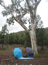
As we left the river valley and entered a temperate rain forest, there continued to be abundant vegetation, but there was a less crowded feeling.  The hills are brimming with trees, but they are taller and there is more space between them.
When we crested the ridge we had hoped to catch a glimpse of the rocky coastline.  Unfortunately, our view was blocked.  We dropped into a second valley where we were forced to ford the Punakaiki River.  I am not a fan of water, so this was not something that I was looking forward to.  The water was not fast moving nor too deep.  However, due to the very rocky bottom we decided to keep on our boots.  Besides, when reading about tramping in New Zealand we read that only novice walkers remove their shoes for river crossings.  Moments into the crossing, the cold water rushed over the top of my boots and my feet became soaked.  The river which appeared to be slow moving from the banks, flexed its power as it rushed passed my calves.  It took my full concentration to not be knocked off my feet.  After what seemed like an eternity I finally reached the other side.  A squeal of delight escaped my lips.  I felt so exhilarated.  As I squished down the dirt road any discomfort I felt was replaced by a feeling of satisfaction, another hiking milestone had been crossed.

Saturday, March 20, 2010

Three Wild And Crazy Critters


This week's PhotoHunt theme is three

This is probably one of the most photographed signs in Australia.  It lets drivers know to keep a look out for feral camels, wombats and kangaroos.  The sign is located between Perth and Adelaide on the Eyer Highway.  The drive between the Western and Southern Australian capitals is considered one Australia's Great Road Journeys.  The trip includes the crossing of the Nullarbor Plain--a 1,100 kilometer drive across an almost treeless landscape.  I've done the trip twice.  Once by train and the other by campervan.

Thursday, March 18, 2010

Polly Wants Some Rubber

We had been duly warned--by travel writers, bloggers, friends, and even the National Park Ranger--Keas would eat anything and everything that you left out at your campsite.  So all of our personal belongings we safely tucked away in the camper van.
We had retired early, the long drive and the several hour time change had left us beat.  The sun had barely set when our heads hit the pillow.  It wasn't long before Mark fell into the the rhythmic breathing of deep sleep and I was quickly following in his footsteps.  Suddenly there was a loud thumping on the roof of the camper van.  Just our luck, a Kea was attacking the pop up window--I couldn't help but wonder if this is why the screen was broken in the first place.  I jumped to my feet and began to beat the roof, in an attempt to scare it away. It flew to the ground and I could only hope that it wasn't attacking the vehicles tires.  To my relief it just stood below the window glaring at me with its beady little eyes.  The cheeky little guy let out a shrilling call before it flew off into the night.
Keas are a large species of parrot.  Its plumage is olive-green and it has orange feathers on the undersides of its wings.  It has a large narrow curved beak.  Its diet consists mainly of roots, leaves, berries, nectar, insects, and on occasions carrion.
The Kea is the world's only mountainous parrot and is found of the South Island of New Zealand.  The birds ability to survive in the harsh alpine environment is attributed to the birds inquisitive nature and its remarkable intelligence.  The species also has a couple physical characteristics: a long, strong,ice pick like beak, and clamp-on like feet which also contribute its ability to survive in the high mountains.
It is believed that there are between 1,000 and 5,000 Keas left in New Zealand.  Use the following link to watch an informative documentary about this mischievous bird.

Wednesday, March 17, 2010

From East To West

We had just crested Arthur's Pass and the view in front of us was noticeably different from where we had just come.  The drier, open landscape of the eastern  Alps was replaced with the lush, dense forest of the west.  Our drive through the Otira Gorge was made even more incredible by the impressive display of the flaming red-flowering southern ra̅ta̅.
We were on a quest for a campground.  Since we had not yet picked up the Conservation Campsites Brochure we were driving aimlessly.  We eventually decided to head towards Lake Brunner.  We figured that a lake that size--40 square kilometers-- had to have some kind of facilities.  Unfortunately, there was not a public campground and we had no choice but to stay in a caravan park--which in all fairness was very nice.  In fact, it wasn't in the distant future that we would reminisce about our stay in the Moana caravan park, a tranquil place that not only had an excellent view, but that wasn't over run by tourists in search of the ultimate adventure.
In addition to a good campground we were excited to learn that there were several hikes in the area.  So first thing the following morning we hit the trail.  From the start I knew that it would be impossible to make it to the summit of Mt. Te Kinga.  The Mt. Avalanche climb had left me extremely sore, and I could not face another steep climb.  However, we were able to make it up the Ara O Te Kinga Track as far as the second look out.
The marked trail head is located on the eastern edge of Lake Brunner.  The well formed track, which is currently being re-routed in the lower parts, takes hikers through a magnificent podocarp forest.  The forest is so dense with vegetation that it is nearly impossible to see something that is not green.  Even the trunks of the trees are blanketed in moss.  The only  time the vision of green is broken, is when there is an opening in the trees and you can catch a glimpse of the sparkling blue water of Lake Brunner.
As we made our ascent I was astonished by the tranquility of the temperate rainforest.  There was not the crunching of the dirt, that we have come so accustomed to on our Australian treks.  In fact, as I watched Mark's feet in front of me it was as though I could see the ground gently sink and rise. The sound from each step was muffled by the moisture-ladened dirt.
My attention was soon drawn from the saturated ground to the thick and heavy air that surrounded us.  Each breath lay heavy in the lungs, and droplets of water gathered on my brow and at the small of the back--not because of exertion but rather because of condensation.  Hiking in such wet and humid areas has become such a foreign experience for us that I felt as though I was somewhere exotic.  The only thing lacking was the appearance of some extraordinary animal.
Our arrival to the second look out came much too quickly.  However, as much as I would have loved to continue to the summit, I knew that I was in no condition to do so.  Instead we returned to our vehicle and set off to see what other delights New Zealand had to offer.

Monday, March 15, 2010

What's Up DOC?

Our visit to Authur's Pass included an introduction to New Zealand's Department of Conservation (DOC) Campsites.  We had yet to find the brochure that listed all of the South Island's Conservation Campsites, so we called in at the National Park's Visitor Center to find out what our local options were.  We learned that we had three choices for the night.
The first, Avalanche Creek Shelter,was conveniently located just across the road and it included toilets and water.  Unfortunately, across the road also meant on the road.  Granted, there wasn't a lot of space with the river, road and rail track running through the narrow pass, but we were disappointed with what appeared to be a large parking lot.  We had envisioned camping in a more natural setting, so we headed down stream to check out our second option.  The setting at Greyneys was a bit better.  It was located in a forested area, but once again it was directly on State Highway 73.  Needless to say, we continued the couple more kilometers to Klodyke Corner.  Here we found a large open campsite that seems to be typical in New Zealand.  The campground, which is located near the junction of the Bealey and Waimakairiri Rivers, consists of a large flat field--which on our visit had been recently mowed.  We were a bit confused and unsure if the mowed area was for caravan or for tents.  At that point we were the only visitors so we had to take a guess.  We ended up playing it safe and followed a light vehicle trail to a remote corner next to the forest.  Our decision provided us with a secluded camping spot that had magnificent views of the surrounding mountains.
As afternoon turned to evening more campers pulled into the camping area.  Like us, many of them seemed unsure of what to do.  A couple of the large vans just pulled over on the side of the road.  A small group of cyclists pulled in, and they headed towards the tree line.
On our subsequent visits to DOC campsites, which unfortunately are not located at all national parks, we learned the etiquette of camping in New Zealand.  Typically, campers are to line the perimeter of the large open area.  We were never in a packed campground, so we never learned if once the outer edge is full if the inner area would be used for camping as well.
Over all our experiences at New Zealand DOC campsites were enjoyable.  We only wished that in a country with so many National Forest there could have been more public campsites.  The several sites that we stayed at offered clean basic facilities for a small fee--we didn't visit any of the full serviced sites.  Most of the locations easily accessible and in a more natural setting.  For those planning a camping trip across New Zealand the Conservation Campsite Brochure is an invaluable tool.

Saturday, March 13, 2010

Koru


This week's PhotoHunter theme is spiral.

In New Zealand the spiral shape of the koru is used by the Maori as a symbol of creation.  The shape which is based on an unfurling fern frond symbolizes new life, growth, strength and peace.  The outer circle conveys the idea of perpetual movement, and its inward coil suggests a return to the point of origin.
The featured carving is in Pounamu--the traditional name used by the local Maori to identify locally sourced jade from Aotearoa New Zealand.

Thursday, March 11, 2010

Heading For The Hills

Christchurch was not far behind when the mountain divide that separates Canterbury and West Coast came into view.  The scene before us was the same that we had seen from the airplane.  However, from the ground it became apparent that the magnificent landscape that dominated the area was not necessarily lifeless, and that the multi-coloredness came from contrasting vegetation and rocks.
The road follows the broad alluvial plain with its braided rivers--a series of small channels separated by small islands--a formation that is found only in a few places in the world.
As we drew closer to the Southern Alps we were in awe of the vast terrain that had been created by a rapid uplift and then eroded over time.  Over millions of years the grey sandstone was carved by glaciers that left large scree slopes, steep gorges, and truncated ridges.
Vegetation at the lower elevations of the valley is limited to shrubs and grasses.  In the riverbeds small patches of herbs, mosses and lichens can be seen.  Forest of mountain beech, the only native tree to grow in the area, dot the hill sides.
Our first stop on the Great Alpine Highway was Kura Tawhiti/Castle Hill Conservation Area.  The area's draw is a series of large, up to 30 meter high, limestone formations.  The boulders can easily be observed from the Highway, but to really appreciate them it is well worth taking the 15 minute walk.  The trail to the boulders is a well developed track, but once at the rock clusters visitors can meander through a network of worn but unmarked tracks.  The day was perfect, but unfortunately time was against us.  We wanted to make sure we found a camp site at Arthur's Pass before sunset, so we had to continue on our way.

Tuesday, March 9, 2010

A View From The Top

We awoke to a clear sky.  It looked like it was a perfect day to tackle Avalanche Peak.  However, we decided to stop in at the Park Ranger's Office to check on the wind speeds at the summit.  We didn't want to find ourselves on the exposed rim in the 100 km winds that were reported on the previous day.  We were informed that things were looking good, and that if we planned to bag the peak--today was the day to do it.  We took the Ranger's advice and skipped the Avalanche Peak Track, which included a steep rock scramble across avalanche debris, and began tramping up Scotts track.  Our choice may have granted us a well formed path to follow, but we were still faced with an extreme ascent.  The trail was limited in zig-zags and instead we were faced with a steep climb that would take us 1,100 meters from our starting point.
In many areas the trail had been eroded and in places the water had washed away much of the dirt.  This left large tree roots exposed, as well as many small cliffs.  Both obstructions on the trail had to be scaled.  The roots provided foot holds and handles to help in the climb, but the muddy cliffs were a slippery mess.  Despite the rough and rugged terrain we were able to clear the tree line in just under 2 hours.  At this point  we were gifted with a magnificent view of Mt. Kaimatau and its Crow Glacier.
The contrast of the dark grey apex of the mountain against the clear blue sky was breathtaking.  The two saddles that lead to the peak in front of us were still snow covered, and it looked as though the mountain was wearing a white wrap.  At first glance it seemed as though the glittery white snow was reflecting the blue of the sky, but instead it was the translucent blue of the icy crystals of the glacier.
Here the track turned to a poled route up the rocky ridges.  We were less than an hour from the summit.  Just as we arrived at our goal, a Kea appeared on a large boulder in front of us.  I assumed the inquisitive bird would stay with us during our rest on the summit, but to my surprise it let out a "keeeaaa" and flew away.
Our picnic lunch was cut short as the clouds began to roll in from the west.  We wanted to make sure we weren't caught in a storm while on the exposed part of the mountain.
As we gradually worked our way down the hills, I knew the views would stay with me for a life time, but I also had a feeling my legs would be reminding me of the experience for the next several days.

Saturday, March 6, 2010

A Foreign Affair

This week's photohunt theme is foreign.

Every summer WOMADelaide is held in Adelaide.  WOMAD stands for "World of Music, Arts and Dance."  The event's aim is to bring together artists from all over the globe. For four days the Adelelaide Botanical Park is turned into a showcase of foreign music, art and dance. 

Thursday, March 4, 2010

Unexpected

My eyes were shut and I was asleep before the plane had even left the runway.  I woke to a view of a sea of white fluffy clouds.  I knew we couldn't be far from our destination since the plane had slowed.  I anxiously peered out the window looking for that first glimpse of New Zealand, but clouds dominated the view.  As I stared off into the horizon the fluffy shapes took on a more angular aspect.  On closer inspection I realized that I was no longer observing masses of water particles, and that the forms in the distance were snow covered peaks.  I could barely contain my excitement and I jabbed Mark in the ribs and pointed out the spectacular view that was coming closer.
I knew that we wouldn't be climbing to the tip of the jagged summits before us, but the thought of being near such an imposing landscape was exciting.  As we drew closer the clouds dissipated and we had an unobstructed view of the apexes and valleys below us.  The view reminded me of flying over the Alps in Europe.
As we traveled southwest the snow covered giants were replaced by a more barren landscape.  I was surprised by the lack of greenery.  I had imagined New Zealand to be lush and vegetated.  I did not expect the lifeless landforms that lay below us.  However, I was not disappointed;  instead I was in awe.  The treeless mountain range below us was rich with color: yellows, greens, whites, pale reds, and grays.  It was as though we were flying over massive multi-colored sand dunes. I couldn't wait to hit the trail and explore this unexpected landscape.

Wednesday, March 3, 2010

A Swell Day

We drove the twisty curvy road in silence.  Mark suggested that I turn on the book on tape we had been listening to, but I felt we needed to focus on the road in front of us.  The zigzag dirt track that was taking us out of the mountainous area of Abel Tasman National Park needed all of our attention.  After all, we didn't know if around the next hairpin curve we would find a speeding logging truck, an enormous motor home, or a mudslide.  I left the radio on seek and occasionally we we would get a note or two of music.  As we neared the summit we tuned in long enough to learn that an undersea tremor near Japan had put the country on standby for a Tsunami.  We were also informed that New Zealand was not in any danger, and that the waves would not be reaching the remote island that we were currently visiting.
At this point in our trip a Tsunami warning wouldn't have affected us much; we would spend most of the day driving across several mountain ranges, leaving the ocean far behind us.  However, the following morning--as we approached the eastern coastal seaboard--we were greeted by a sign with a Tsunami warning on the side of the road.  We assumed that it was related to the previous day's tremor and didn't give it much thought as we continued on our way.

The meandering coastal road between Blenheim and Kaikoura is sandwiched between majestic mountains and the ocean.  The contrast of the dense rainforest growth on our right with the black sand and blue water on our left was stunning.  Several small communities dotted the road.  We had hoped to call in for a cuppa joe, but to our surprise none of the cafes or crawfish shacks were open, so we were out of luck.  An occasional car would pass us, but for the most part the area we were driving through had a sleepy feel to it.  It was almost as though things were closed down for the season, but that was hard to believe considering how many tourists we had encountered over the last week.  

When we passed a yellow sign announcing seal crossing, Mark quickly pulled over.  To my delight there were several seals on the rocky ledge next to the road.  They were lazily sunning themselves. There was some movement in the water.  What we first though to be seals coming in for a landing turned out to be frolicking dolphins, who repeatedly jumped up out of the water.  At the sight of each ariel flight I squealed in delight.

In the distance we could see the cliffside town of Kaikoura.  As we stood in the sun admiring the view, we decided that instead of heading for the hills we would make Kaikoura our destination for the day.  We had read about a seaside hike in the area and figured we could get the details at the tourist office.
The tourist office was easy enough to find.  Amazingly enough there were plenty of parking spaces, and there were just a few tourists walking around.  Once again this struck us as odd, especially since for the last week whenever we found ourselves in a populated area parking was difficult to come by.  With the Campervan parked in the front row, we eagerly entered the building and approached the counter--we were anxious to hit the trail.  You can only imagine the look on our faces when we were informed that the coastal trail was closed because of the Tsunami warning.  Our confusion prompted the woman behind the counter to advise us that due to the large earthquake that had occurred at 3 a.m. in Chile the costal area was under a watch. Large waves had already hit New Zealand's Chatham Islands, and the area where we were standing was the possible next target.  Hmmm, no wonder everything was closed and just a few brave souls were out and about--there was a possible massive force moving our way!  Needless to say, we decided to not to stick around to see if the waves arrived.  Instead, we stuck to our original plan and headed for the hills.
We later learned that the area did experience waves up to 1.5 meters and several surges, but fortunately it was during a very low tide so no damage occurred.